High Sweden Bridge Walk — Ambleside Circular Route Guide
Town Walk · Ambleside · Packhorse Bridge & Scandale
A circular walk from Ambleside to High Sweden Bridge — a centuries-old packhorse bridge in Scandale, returning via Low Sweden Bridge with sweeping Windermere views. Free GPX and tips.
Walk Description
The High Sweden Bridge walk is one of Ambleside's best-loved circulars — a scenic Lakeland loop that climbs the quiet Scandale valley to a beautiful centuries-old packhorse bridge, then returns along a high path with sweeping views over Lake Windermere and the Fairfield fells. Starting right from the edge of town, it offers a true taste of the fells without demanding a full mountain day: dry-stone-walled bridleways, tumbling Scandale Beck, and a wonderful sense of climbing into wilder country within minutes of the shops and cafés. The graceful single-arch bridge, worn smooth by centuries of hooves and boots, is the picture-perfect turnaround, and the return leg is the icing on the cake — a broad ridge path unveiling Windermere stretching away to the south, backed by the Langdale Pikes, Bowfell and the Crinkle Crags. Short enough for an afternoon yet packed with history and views, this is the ideal introduction to walking around Ambleside for families, first-timers and anyone wanting a rewarding half-day on the fell fringe.
Ambleside to Sweden Bridge Lane
From Rydal Road car park on the northern edge of Ambleside, cross the road near the mini-roundabout and head uphill past the tiny Golden Rule pub, then bear left onto Sweden Bridge Lane. The lane climbs gently — tarmac at first, then opening into a stony bridleway between ancient dry-stone walls. As you rise, look left for lovely views over the town with Loughrigg Fell and Rydal Water beyond, while the steep flanks of Wansfell Pike loom to your right. Keep an eye out for the curious 'Tower of Friendship and Beauty' folly in the grounds of Eller How — built by the botanist Henry Boyle, it bears the carved names of famous visitors, including the Wordsworths.
Up the Scandale Valley
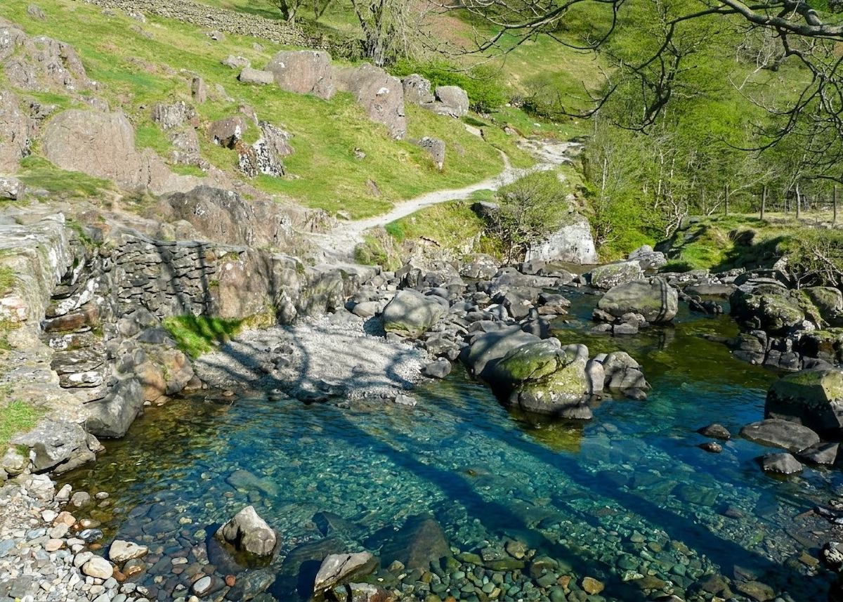
The bridleway settles into a steady, enjoyable climb up the Scandale valley, following the line of Scandale Beck as it chatters over rocks below you. Pass through a gate and continue up the valley floor, the walls giving way to open fellside and a real feeling of leaving the town behind. This is easy, rhythmic walking on a good surface, with the higher Fairfield fells drawing the eye ahead. Sheep — and occasionally Highland cattle — graze the valley, so keep dogs on a lead. About a mile up, the ancient packhorse bridge comes into view, framed by the fells.
High Sweden Bridge
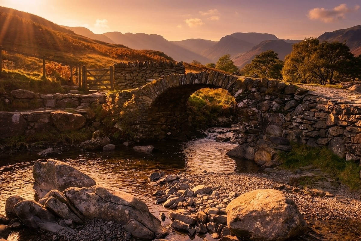
You reach the walk's centrepiece: High Sweden Bridge, a beautiful single-arched packhorse bridge dating from the late 1700s. It once formed part of an important trade route between Ambleside and Patterdale before the Kirkstone Pass road took over, and its stones are worn to a smooth sheen by centuries of foot and hoof traffic. It's a wonderful, photogenic spot to pause. Cross the bridge and climb the stepped path on the far side — this is the steepest section of the whole walk, but it's short-lived. Once you're over the stile at the top, the hard work is behind you and the views are about to be spectacular.
The High Return & Low Sweden Bridge
From the high point, the return leg rewards you handsomely. The path follows a broad ridge south, and Ambleside spreads out below with the silver expanse of Lake Windermere stretching away to the south, backed by Latterbarrow and Claife Heights. On a clear day the Langdale Pikes, Bowfell and Crinkle Crags punctuate the western skyline. The path descends steadily and swings left to cross Low Sweden Bridge, where Scandale Beck tumbles over small cascades. From here a lane leads past Nook End Farm and the University of Cumbria campus back into the heart of Ambleside and your starting point.
Route Essentials
- Parking: Rydal Road car park on the northern edge of Ambleside is the ideal start — the walk begins directly opposite. It fills quickly in peak season; Miller Bridge car park at the south end of town is a good backup.
- The steep bit: the only real climb is the stepped path immediately after crossing High Sweden Bridge — take it steady, and it's over quickly.
- Terrain & footwear: the bridleway and fell paths are rocky, muddy and slippery in places, especially after rain. Sturdy waterproof walking boots are recommended year-round.
- Livestock: sheep and occasionally Highland cattle graze the valley and fields. Keep dogs on a lead throughout and give the cattle plenty of space.
- Local curiosity: the name 'Sweden' has nothing to do with Scandinavia — it likely derives from the Old Norse word 'swidden', meaning a field cleared by burning.
- Facilities: there are no facilities on the walk, but Ambleside has abundant pubs, cafés, toilets and shops a few minutes from either bridge — perfect for before or after.
- Safety Notice: The GPX file and route information on this page are for general guidance only. Always carry an OS map and compass, check the weather forecast, and tell someone your plans before setting out. You walk at your own risk.
Gallery
Route Map
What to Bring
- Sturdy waterproof walking boots
- Waterproof jacket and a warm layer
- Water and a snack or picnic
- OS Explorer OL7 map
- Phone with the OS Maps app
- Camera for the bridge and Windermere views
- Dog lead (livestock in the valley)
- Sun protection on clear days
Best Time to Visit
This is a genuine year-round walk, but spring through autumn gives the surest footing and the clearest views down Windermere. Spring brings lambs in Scandale and fresh green in the valley, while autumn lights the fellsides in bronze and gold. Summer is lovely but Ambleside is busy, so arrive early for parking. Even in winter it's a fine short outing on a crisp, clear day — just take care on the muddy bridleway and the steep steps above the bridge, which can be greasy or icy.
Local Weather (yr.no)
Forecast provided by yr.no
Safety Information
Important: The GPX file and route description on this page are for general guidance only and should not be relied upon as a sole means of navigation. GPX tracks are approximate and may not reflect current ground conditions, path diversions, or seasonal changes.
Always carry an Ordnance Survey map and a compass, and know how to use them. Check the weather forecast before setting out, tell someone your planned route and expected return time, and wear appropriate footwear and clothing for the conditions.
UKLakeDistrict.com accepts no responsibility for any loss, injury, or damage arising from the use of route information or GPX files provided on this site. You walk entirely at your own risk.
Route Essentials
Frequently Asked Questions
How long does the High Sweden Bridge walk take from Ambleside?
Most walkers complete the circular route in 2 to 3 hours, covering around 4.8 km (3 miles) with about 239 m of ascent. It's an easy-to-moderate half-day walk with only one short steep section just after the bridge. Allow extra time to enjoy the packhorse bridge and the Windermere views on the return leg.
Where do you park for the High Sweden Bridge walk?
The most convenient car park is Rydal Road car park on the northern edge of Ambleside — the walk starts directly opposite. Miller Bridge car park at the south end of town is a good backup if Rydal Road is full. Ambleside is also well served by buses, making a car-free visit straightforward.
Is the High Sweden Bridge walk dog friendly?
Yes, it's a popular dog walk, but sheep and occasionally Highland cattle graze the Scandale valley and surrounding fields, so dogs must be kept on a lead throughout. Give any cattle a wide berth, and keep dogs close on the lane sections through town at the start and finish.
What does the name 'Sweden Bridge' mean?
Despite the name, there's no Scandinavian connection. It most likely comes from the Old Norse word 'swidden', meaning land cleared by burning — a common farming practice in the area. High and Low Sweden Bridges take their name from this old cleared ground in the Scandale valley, not from the country of Sweden.
How old is High Sweden Bridge?
High Sweden Bridge is a packhorse bridge dating from the late 1700s. It once carried an important trade route between Ambleside and Patterdale, before the building of the Kirkstone Pass road made it redundant. Its single graceful arch and stones worn smooth by centuries of use make it one of the most photographed old bridges in the Lake District.
Is the walk suitable for children and beginners?
Yes — it's an excellent first fell-fringe walk for families and beginners. The distance is modest, the paths are clear, and only the short stepped climb after the bridge requires a little effort. Children love the packhorse bridge and the beck. It's not suitable for pushchairs (rocky bridleway and steps), but it's ideal for reasonably steady young walkers.
What are the views like on the return leg?
The high return path is the highlight for many. From the ridge you look south over Ambleside to the full length of Lake Windermere, with Latterbarrow and Claife Heights beyond, and on a clear day the Langdale Pikes, Bowfell and Crinkle Crags along the western skyline. It's a genuinely grand panorama for such a short and accessible walk.
Can I extend the High Sweden Bridge walk?
Yes. Strong walkers can continue up the Scandale valley beyond High Sweden Bridge to Scandale Pass, or link the route into the classic Fairfield Horseshoe for a full mountain day. The bridge also connects to paths towards Wansfell Pike and Troutbeck. For a gentler add-on, combine the walk with a stroll to Stock Ghyll Force waterfall on the other side of Ambleside.