 UKLakeDistrict
Old Man of Coniston
Wainwright · Southern Fells · 803m
Old Man of Coniston circular walk: 8.1 km and 3.5–5 hours via Low Water and Goat's Water, with route map, free GPX, car park, difficulty and summit facts.
Route map & downloads
Loading the interactive route map…
Map not included: carry OS Explorer OL6 and a compass.
- Start / parking
- Walna Scar Road Car Park
- Postcode
- LA21 8HD
- Without a car
- The 505 bus serves Coniston village; allow 30–40 minutes extra each way to walk to the start.
Step-by-step route
The Old Man of Coniston is one of the great cornerstones of Lake District hiking — a shapely 803-metre fell that rises straight from the village and packs mountain tarns, dramatic crags and a rich industrial history into a single satisfying circular walk. This 8.1km loop is the classic way to climb it: a steady ascent past the atmospheric ruins of the Coniston copper mines and quarries, up to the still, dark waters of Low Water cradled beneath the summit crags, and on to the huge summit cairn with its legendary panorama. The descent is even finer, curving beneath the soaring cliffs of Dow Crag, past the wild tarn of Goat's Water, and back along the ancient Walna Scar Road packhorse track. On a clear day the top gives a 360-degree sweep from Coniston Water and the Furness coast to the Scafells and, out west, the shimmer of the Irish Sea. Accessible enough for a fit first-timer yet grand enough to feel like a proper mountain, the Old Man is many walkers' introduction to the higher Lakeland fells — and a summit they return to again and again.
Walna Scar Road to the Copper Mines
From the Walna Scar car park above Coniston — a rough, high starting point that saves you a good chunk of climbing — take the clear track that swings right and up into the coombe below the fell. You are soon walking through the extraordinary landscape of the Coniston copper mines, a working industry here for centuries: spoil heaps, ruined buildings, old levels and the scars of quarrying are everywhere. The path climbs steadily on a well-engineered miners' track, atmospheric and full of interest, with Church Beck tumbling below. Keep to the main path as it zig-zags up towards the hanging valley, the crags of the summit ridge closing in above you.
Low Water to the Summit
The track lifts you into a rocky bowl to reach Low Water, a beautiful glacial tarn sitting dark and cold beneath the summit cliffs at around 550 metres — a classic spot for a breather. From here the path steepens in earnest, climbing a series of well-pitched zig-zags up the eastern flank. It is the stiffest pull of the day but it's short, and the views back over Low Water and out to Coniston Water grow with every step. A final rise brings you to the broad summit ridge and the enormous summit cairn at 803 metres, a sturdy stone-built beacon that has guided walkers for generations.
The Summit (803m) & The Panorama
The Old Man's summit is one of the finest viewpoints in the southern Lakes. Laid out below is the full length of Coniston Water, with the Furness peninsula and Morecambe Bay beyond; sweep north-west and the Scafell range, Bowfell and the Crinkles fill the skyline, while to the west the sea glitters towards the Isle of Man on a clear day. It's an ideal place for lunch and a good long look at the map. When you're ready, continue along the ridge south-west towards Brim Fell and the descent — do not simply reverse your steps, because the circular return is the best part of the walk.
Goat's Hause & Dow Crag
Follow the ridge path as it curves down to Goat's Hause, the col between the Old Man and the magnificent rock peak of Dow Crag. The buttresses of Dow Crag are among the most impressive in the district and a famous climbers' playground — well worth pausing to admire. From the hause the path drops down towards the tarn, and the character of the walk changes completely: wilder, quieter and more dramatic than the busy summit route, with the crags towering overhead. Take care on the loose, rocky descent, which can be awkward when wet.
Goat's Water & the Walna Scar Return
The path descends to the shore of Goat's Water, a starkly beautiful tarn trapped between the Old Man and Dow Crag — a superb, brooding spot that feels far from anywhere. From the outflow, follow the path down and east to join the Walna Scar Road, an ancient packhorse route that once carried slate and copper across the fells. Turn left (east) and follow this broad, historic track on an easy, steady gradient all the way back to the car park, with grand views opening out over Coniston and the Yewdale fells to see you home.
Route Essentials
- Parking: The Walna Scar Road car park (LA21 8HD) sits high above the village and cuts a big slice off the ascent, but it's rough, unsurfaced and fills very early — the final approach road has potholes, so drive slowly. If it's full, use the car parks in Coniston village near the Ruskin Museum and walk up via Church Beck (add 30–40 minutes each way, but you'll pass Miners Bridge and lovely waterfalls).
- Terrain: Expect rocky miners' tracks, well-pitched zig-zags, and a loose, stony descent from Goat's Hause. Sturdy boots with good grip are essential, especially for the wet rock around Goat's Water.
- Industrial heritage: The old copper-mine workings are fascinating but dangerous — never enter old levels, shafts or spoil tunnels, and keep children and dogs close on this section.
- Navigation: The summit and Goat's Hause can cloud over quickly. Carry the OS Explorer OL6 map and a compass; in mist, take care not to stray onto the steep ground above Dow Crag.
- Facilities: There are no facilities on the fell. Coniston village has pubs, cafés, toilets and shops — the Black Bull and the Ruskin Museum are popular pre- or post-walk stops.
- Weather: This is a proper mountain at 803m — the summit is far colder and windier than the village. Pack warm and waterproof layers and check the mountain forecast before setting off.
- Safety Notice: The GPX file and route information on this page are for general guidance only. Always carry an OS map and compass, check the weather forecast, and tell someone your plans before setting out. You walk at your own risk.
Gallery
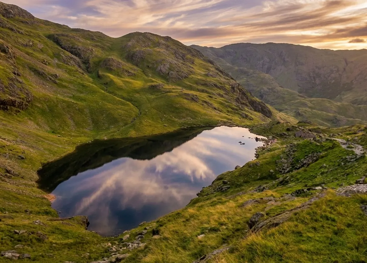
Video Guide
What to Bring
- Sturdy walking boots with good grip
- Waterproof jacket and over-trousers
- Warm layer, hat and gloves
- OS Explorer OL6 map and a compass
- 1.5–2 litres of water per person
- Lunch and high-energy snacks
- Fully charged phone and a power bank
- Small first-aid kit
- Sun protection — hat, sun cream, sunglasses
- Camera or binoculars for the summit panorama
Best Time to Visit
Spring to autumn gives the most reliable conditions and the longest daylight for the full circular route. Clear, settled days after a cold front deliver the best chance of the far-reaching summit views out to the Scafells and the sea. Summer weekends are busy on the popular ascent, so start early or go midweek for a quieter fell; the wilder Goat's Water side is always quieter. In winter the tops can hold snow and ice, turning the zig-zags and the Dow Crag descent into serious ground that needs winter kit and experience — save the full loop for a good forecast.
Local Weather (yr.no)

Forecast provided by yr.no
Mountain forecasts
Summit conditions can be far colder, windier and cloudier than the valley. Check a specialist mountain forecast before you set out:
Safety Information
Important: The GPX file and route description on this page are for general guidance only and should not be relied upon as a sole means of navigation. GPX tracks are approximate and may not reflect current ground conditions, path diversions, or seasonal changes.
Always carry an Ordnance Survey map and a compass, and know how to use them. Check the weather forecast before setting out, tell someone your planned route and expected return time, and wear appropriate footwear and clothing for the conditions. In an emergency dial 999, ask for the Police, then Mountain Rescue. Read our fell safety guide before your first walk.
UKLakeDistrict.com accepts no responsibility for any loss, injury, or damage arising from the use of route information or GPX files provided on this site. You walk entirely at your own risk.
The Old Man of Coniston: History, Extensions & Local Guide
Old Man of Coniston: quick facts
The Old Man of Coniston is an 803-metre (2,634 ft) fell above the village of Coniston in the southern Lake District, and one of Alfred Wainwright's 214 Lakeland fells. It was the highest point in the historic county of Lancashire. The circular walk on this page is the most popular way up.
| Question | Answer |
|---|---|
| How high is it? | 803 m (2,634 ft); summit grid reference SD 272 978 |
| How long is the circular walk? | 8.1 km (5.0 miles) with 602 m of ascent, from the Walna Scar Road car park |
| How long does it take? | 3.5–5 hours for most walkers; add 30–40 minutes each way if you start in Coniston village |
| How hard is it? | Graded Challenging: a steady, rocky climb on clear paths, with a steep, loose section on the descent from Goat's Hause. Fit beginners manage it in good weather. |
| What's the easiest route? | The quarry path up past Low Water from Walna Scar Road, the line this guide takes on the way up, is the easiest and most-used route |
| Where do you park? | Walna Scar Road car park (LA21 8HD), or the pay-and-display car parks in Coniston village |
| Which map do you need? | OS Explorer OL6 (The English Lakes, South-western area) |
| Is it dog friendly? | Yes. Keep dogs on a lead near sheep and around the old mine workings. |
For more walks in the valley, see our Coniston & Hawkshead walks or the full list of Wainwright walks.
Four centuries of copper and slate
Few Lakeland fells wear their history as openly as the Old Man. Copper has been worked in the valley above Coniston since at least the late 1500s, when the Company of Mines Royal brought skilled German miners to Cumbria to develop the ore. The industry rose and fell for the next three centuries and reached its peak in the mid-1800s, when hundreds of men and boys worked the levels, water wheels and dressing floors of what is now called Coppermines Valley.
By the early 20th century the mines had closed, but the landscape they left behind is a remarkable open-air museum: leats and reservoirs that once powered machinery, collapsed adits, spoil heaps streaked green with copper minerals, and the old miners' cottages that now house a youth hostel. Higher up the fell, the terraces and tips of the slate quarries tell a parallel story — Coniston's fine blue-grey slate was prized as a roofing and building stone, and the zig-zag tracks you climb on this walk were built to serve the quarries.
Treat the workings with respect. Hidden shafts and unstable ground remain, and the old levels are extremely dangerous to enter. Enjoy them from the path, and if you want to learn more, the Ruskin Museum in the village has excellent displays on the mines and quarries.
Coniston Water: speed records, Ruskin and Swallows and Amazons
The view from the summit is dominated by Coniston Water, and the lake has a story every bit as rich as the fell. It was here that Sir Malcolm Campbell set a world water-speed record in 1939, and where his son Donald Campbell was killed in January 1967 when his jet hydroplane Bluebird K7 somersaulted at over 300mph during a record attempt. The wreck and Campbell's body were recovered in 2001, and the restored boat has since returned to Coniston. Donald Campbell is buried in the village churchyard.
On the eastern shore stands Brantwood, home of the Victorian art critic and social thinker John Ruskin from 1872 until his death in 1900; he too is buried in Coniston, and the Ruskin Museum bears his name. Children's author Arthur Ransome knew the lake from boyhood, and it helped inspire the setting of Swallows and Amazons — Peel Island, near the southern end, is widely regarded as the model for Wild Cat Island.
To see the lake from the water after your walk, the National Trust's restored Victorian steam yacht Gondola and the Coniston Launch both run seasonal cruises from the village piers.
Extending the walk: the Coniston Round and Dow Crag
Once you've climbed the Old Man via our circular route, the obvious next step is the Coniston Round — a classic horseshoe that continues north from the summit over Brim Fell, Swirl How and Great Carrs before dropping down over Wetherlam and back through Coppermines Valley. It's a long, high day of around 10–12 miles depending on your start and finish, so it needs good weather, good navigation and an early start.
On Great Carrs you'll find a poignant memorial: a cross and the remains of the undercarriage of a Halifax bomber that crashed on the ridge in October 1944 while on a night navigation exercise, killing all of its crew. Walkers often leave poppies there.
For a shorter extension, add the summit of Dow Crag from Goat's Hause. The top is a rocky perch above one of the most impressive cliff faces in the Lakes; a short scramble is needed to reach the true summit, and the edges are sheer, so keep well back in wind or mist. Its summit is a Wainwright in its own right, making it an easy extra tick for fell-baggers.
Getting to Coniston without a car
Coniston is served by the 505 Coniston Rambler bus from Windermere and Ambleside via Hawkshead, which makes a car-free ascent entirely possible — check the Stagecoach timetable before you travel, as services are reduced outside the summer season. From the bus stop in the village, allow an extra 30–40 minutes each way to walk up to the Walna Scar Road start, or follow the lovely Church Beck path past Miners Bridge straight into Coppermines Valley.
Arriving by bus also frees you to enjoy a drink in the village afterwards and relieves pressure on the small and often overflowing Walna Scar car park.
More walks around Coniston
Coniston is one of the best bases in the southern Lake District. For a gentler day with a big view, our Black Crag walk combines waterfalls, Tarn Hows and a low Wainwright summit, while the Tarn Hows and Tom Gill circular is ideal for families or a short afternoon. If the Old Man has given you a taste for bigger mountains, Scafell Pike from Wasdale is the natural next challenge, and our Wainwright walks hub lists every fell we cover.
After the walk, the Black Bull — home of the Coniston Brewery and its award-winning Bluebird Bitter — and the Sun Hotel are traditional walkers' pubs, while the cafés by the lake piers are perfect for tea and cake with a view back up to the summit you've just climbed.
Guide last updated .
Frequently Asked Questions
How long does it take to walk the Old Man of Coniston?
The classic circular route via Low Water and Goat's Water takes most walkers 3.5 to 5 hours, covering 8.1 km (5 miles) with around 602 m of ascent. Starting from the high Walna Scar car park saves time; starting from Coniston village adds roughly 30–40 minutes each way. Allow extra time to explore the copper-mine ruins and to linger at the summit and the tarns.
Where do you park for the Old Man of Coniston?
The most convenient parking is the rough Walna Scar Road car park (LA21 8HD) high above Coniston, which reduces the total climb. It fills very early on weekends and the access lane is potholed, so drive carefully. If it's full, use the village car parks in Coniston near the Ruskin Museum and walk up via Church Beck — a longer but very scenic alternative past Miners Bridge.
Can a beginner climb the Old Man of Coniston?
Yes — with a moderate level of fitness and proper gear, the Old Man is a popular 'first big fell'. The paths are clear and well-made and there's no scrambling on the main route, but the summit pull is steep and the Goat's Water descent is rocky. Carry a map and compass, wear sturdy boots, check the mountain weather forecast, and pick a settled day for your first ascent.
Is the Old Man of Coniston a circular walk?
Yes, and the circular is the best way to do it. The route climbs via the copper mines and Low Water to the summit, then descends a completely different and wilder way over Goat's Hause, past Dow Crag and Goat's Water, returning along the historic Walna Scar Road. Going up one way and down the other gives far more variety than an out-and-back, and keeps you away from the busiest path on the descent.
What are the copper mines on the Old Man of Coniston?
The Coniston copper mines are the remains of an industry that worked these fells for centuries, peaking in the 1800s. As you climb you pass spoil heaps, ruined buildings, old tramways and mine levels — a genuinely atmospheric slice of Lakeland industrial history. They're fascinating to walk through but hazardous: never enter old shafts, levels or tunnels, and keep children and dogs close, as hidden workings and unstable ground remain.
What are the views like from the summit?
Exceptional. The 803 m summit looks straight down the length of Coniston Water to the Furness coast and Morecambe Bay, with the Scafell range, Bowfell and the Crinkle Crags ranged across the northern skyline. On a clear day you can pick out the Isle of Man and the glint of the Irish Sea to the west. It's one of the best all-round viewpoints in the southern Lake District.
Is the Old Man of Coniston dog friendly?
Yes, dogs are welcome and it's a popular fell for them, but keep your dog under close control or on a lead around the grazing sheep, near the old mine workings, and on the steep ground above Dow Crag. The rocky descent and long day suit a reasonably fit dog; carry extra water, as the tarns aren't always the best drinking source and there's none on the tops.
How high is the Old Man of Coniston?
The Old Man of Coniston stands 803 metres (2,634 feet) above sea level, making it one of the higher Wainwrights and the dominant fell above Coniston village. This walk climbs around 602 m of ascent from the Walna Scar car park to reach it. Its height and position give the summit its famously wide panorama across the southern fells and out to the coast.
Nearby walks
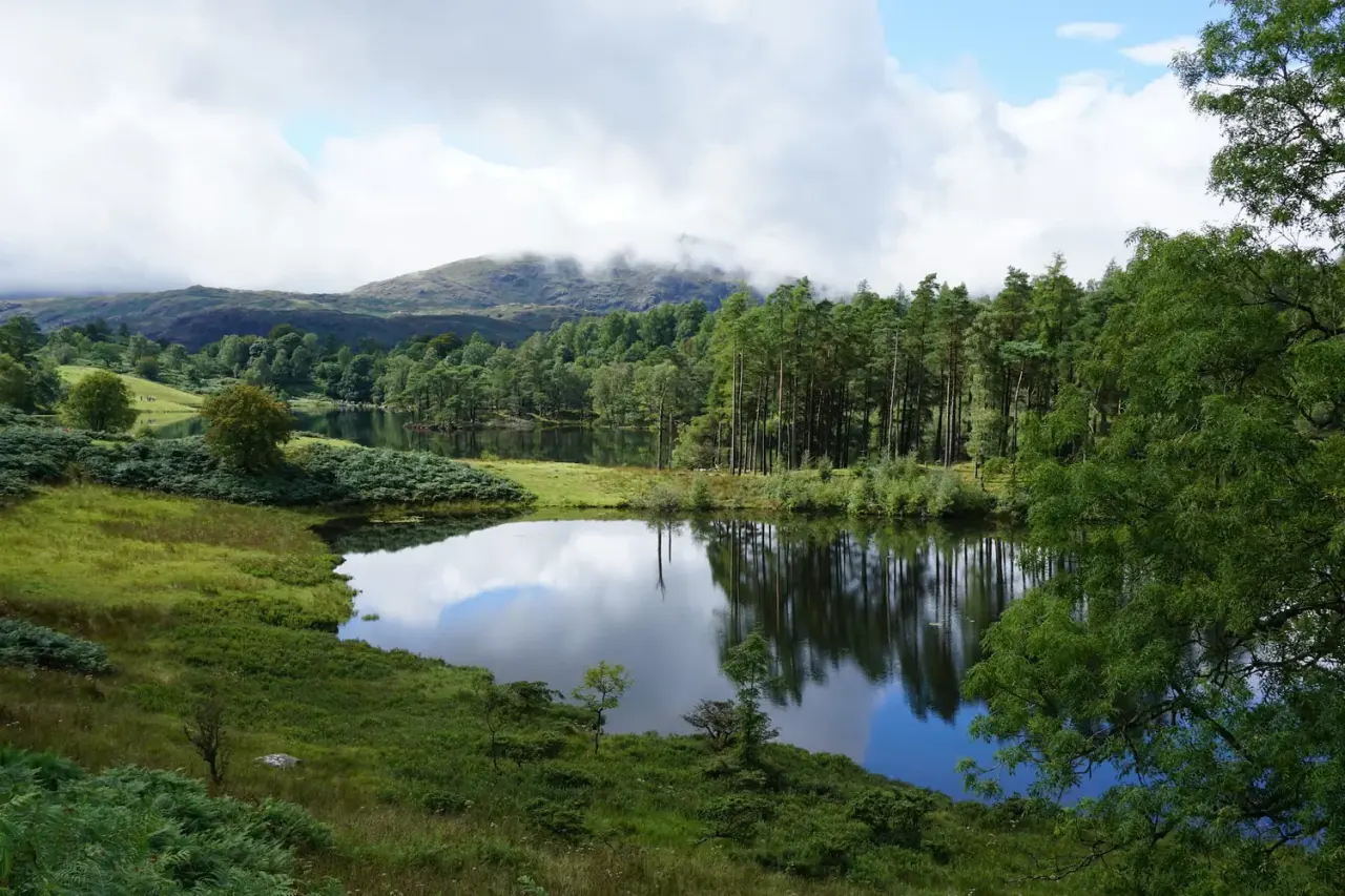
Tarn Hows & Tom Gill
A short Coniston circular via the Tom Gill waterfalls to Tarn Hows, with an OS map, free GPX download and honest parking and accessibility info.
Read guide: Tarn Hows & Tom Gill →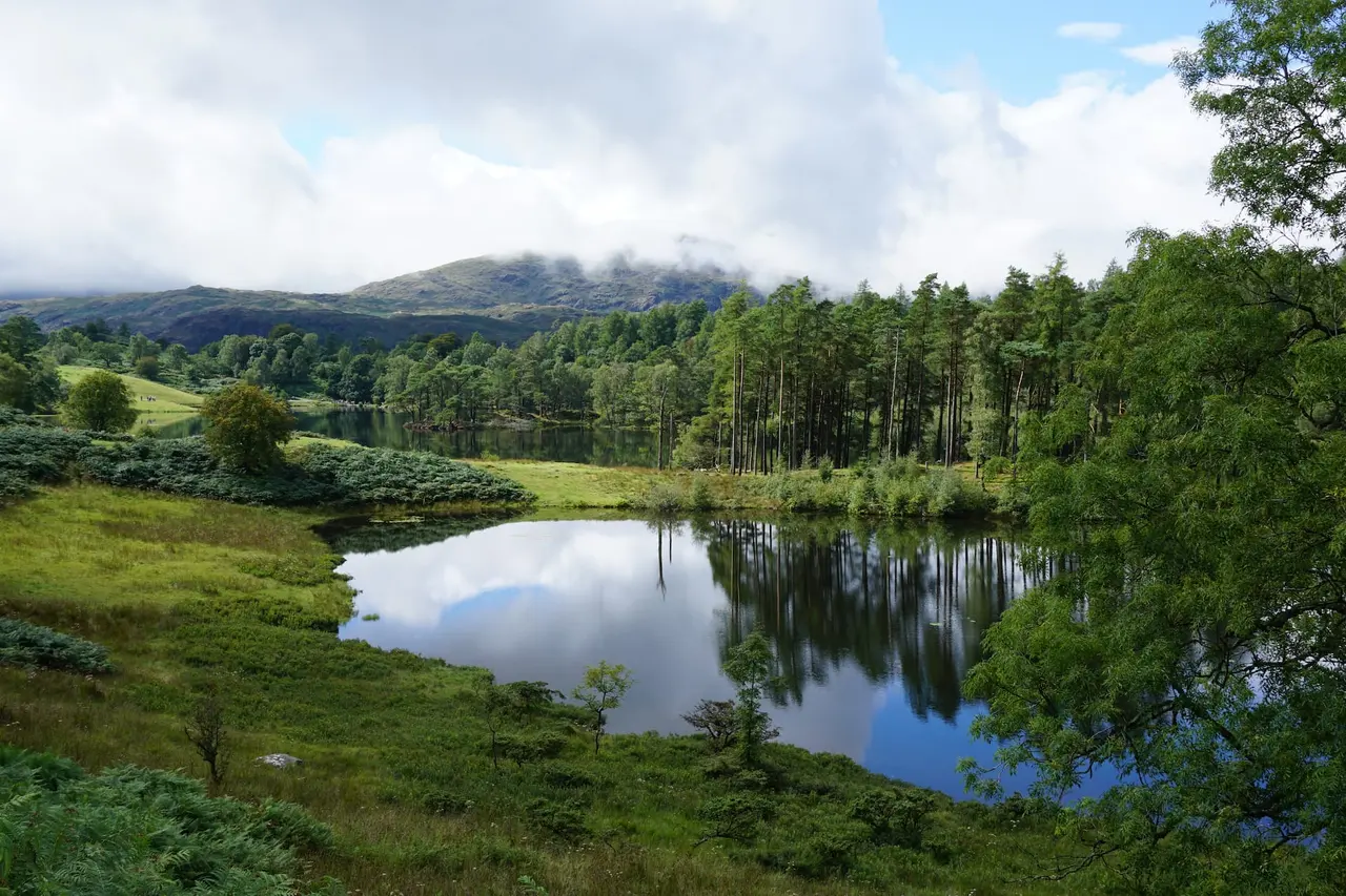
Black Crag & Tarn Hows
A circular walk linking the Tom Gill waterfalls, Tarn Hows and the Wainwright summit of Black Crag above Coniston. Free GPX, parking and timings.
Read guide: Black Crag & Tarn Hows →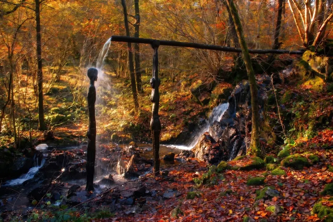
Force Falls, Grizedale
A circular walk through Grizedale Forest, its sculptures and Satterthwaite village to the hidden cascade of Force Falls. Free GPX, parking and tips.
Read guide: Force Falls, Grizedale →
Whorneyside Force
A quiet route from the Old Dungeon Ghyll up Oxendale to a hidden Langdale waterfall, ending at a legendary hikers' pub. Free GPX, parking and tips.
Read guide: Whorneyside Force →