 UKLakeDistrict
Gummer's How
Outlying Fell · Far Eastern Fells · 321m
Gummer's How walk: a 2.7 km family-friendly climb from a free Forestry England car park to a 321 m summit above Windermere. Route map, free GPX and tips.
Route map & downloads
Loading the interactive route map…
Map not included: carry OS Explorer OL7 and a compass.
- Start / parking
- Gummer's How Car Park (Forestry England)
- Postcode
- LA12 8NW
- Grid ref
- SD 389 876
- Parking
- Free
Step-by-step route
The Gummer's How walk is the Lake District's finest reward-for-effort fell — a short, family-friendly climb that hands you a full-length panorama of Lake Windermere for barely an hour's work. Because the Forestry England car park already sits at around 200 metres, you have only about 134 metres of actual ascent to the 321-metre summit, which is exactly what makes this the perfect starter fell for young children, nervous first-timers and anyone easing back into the hills. Rising from the woodland of Astley's Plantation, a staircase of stone-pitched steps leads you up through heather and open fell to a trig point crowning views that stretch from the Coniston Fells and Langdale Pikes in the north to Morecambe Bay, Newby Bridge and the wide Furness coastline in the south. Alfred Wainwright loved it, including it in The Outlying Fells of Lakeland and fondly calling it "an old man's mountain" — the sort of hill where, when your legs can no longer manage it, the sad day has come to hang up the boots for good. Compact, spectacular and endlessly repeatable, Gummer's How proves you don't need a big mountain day to feel like you're standing on top of the world.
The Forest Path
From the Forestry England car park at Astley's Plantation, resist the urge to walk straight up the road. Instead head slightly uphill, away from the tarmac, to pick up the safer woodland path that runs parallel to it through the trees. This shady lower stretch leads to a gate on your left; pass through, cross the road with care — it can be busier than you'd expect on a fine weekend — and a kissing gate directly opposite marks the official start of the fell path. Take a moment here to appreciate the head start you've been given: the car park already sits at roughly 200 metres, so a good half of the day's climbing is behind you before you've truly begun. The going underfoot is gentle and grassy at first, threading between bracken and the occasional hawthorn, with the first tantalising glimpses of blue water opening up between the branches to your right.
The Stone Steps
Beyond the kissing gate the deceptively flat start soon gives way to a well-pitched staircase of stone steps climbing steadily through heather, bilberry and bracken. This is the workhorse section of the walk — honest, rhythmic ascent that lifts you quickly out of the trees and onto open fell. The steps are uneven in places and their smooth tops can be slick after rain, so watch your footing and take children by the hand on the steeper risers. The effort is short-lived and richly repaid: as you rise, pause and turn around, and the southern tip of Windermere begins to unfurl below you, backed by the wooded knolls of Finsthwaite. With every step the sense of climbing a proper mountain in miniature grows, and the horizon widens to take in fell after fell.
The Split Path — Choose Your Route
A little over halfway up, the path divides, and this is the crucial decision point for families and mixed-ability groups. To the left lies a short rocky scramble that asks for a little hands-on effort over boulders and worn rock — good fun for older children and confident walkers who fancy a scramble. To the right, a gentler grassy sweep curves up and around the fell, ideal for younger legs, tired legs and anyone less sure on rocky ground. Both routes reunite just below the summit, so there is genuinely no wrong choice — you can even go up one way and come down the other. Do note that neither option is suitable for pushchairs or buggies; the terrain is simply too rough and steep. If you're carrying a very young child, a back carrier is far more practical than any wheels.
The Summit & Trig Point
The 321-metre summit is crowned by a white triangulation pillar, and the reward is out of all proportion to the effort spent reaching it. Laid out below is the full length of Lake Windermere, England's largest lake, curling away northwards toward the central fells. Sweep your eyes around and you'll pick out the Coniston Fells and the distinctive spikes of the Langdale Pikes to the north-west, the fells of the Kentmere and Kirkstone country to the north, and — turning south — the glittering expanse of Morecambe Bay, the village of Newby Bridge, and the wooded hamlet of Finsthwaite. It's a superb spot for a picnic, a flask and a good long sit; on a clear day you could name landmarks for an hour. This is the classic turnaround point, and many walkers simply retrace the outward route back down to the car park.
The Circular Descent & Extending the Walk
For a more satisfying finish that avoids down-climbing the rocky scramble — which can be awkward in the wet — you can make a short loop. From the trig point, bear left (north) for around 100 metres to a small knoll, then take one of the minor paths bearing right to traverse gently beneath the summit before rejoining the main path lower down the fell. If you've the appetite for more, Gummer's How pairs beautifully with the wider area: drop down to the National Trust's Fell Foot Park on the shore of Windermere for a lakeside picnic and the Boathouse Café, or head to the peaceful High Dam tarn above Finsthwaite for an easy woodland-and-water extension. Either turns a quick summit into a proper half-day out.
Route Essentials
- Parking: The Forestry England car park on Fell Foot Brow (a steep lane off the A592 near Newby Bridge) is free but has only around 20 spaces, and it fills fast on fine weekends and in school holidays — arrive early, or use the roadside lay-bys further along Fell Foot Brow if it's full. Use postcode LA12 8NW and OS grid reference SD 389 876 to be definitive, as several conflicting postcodes circulate online. Google Maps location.
- Getting there: Fell Foot Brow leaves the A592 between Newby Bridge and Bowness, on the eastern side of Windermere's southern end. The lane is narrow and steep, so take it slowly and watch for walkers and oncoming cars.
- Terrain & footwear: Sturdy walking boots or trainers with good grip are essential. The lower paths are frequently churned to mud by grazing cattle, and the stone steps are uneven and slippery when wet or frosty.
- The Luing cattle: The fell is grazed by a hardy Luing herd (a Highland × Shorthorn cross) that Forestry England use for conservation grazing to manage the vegetation and maintain the fell's floral diversity. Keep dogs on a lead, give the cattle plenty of space, and never get between a cow and its calf.
- Facilities: There are no toilets or refreshments on the walk itself. The nearest facilities are the National Trust Boathouse Café at Fell Foot Park, or the pubs and cafés at Newby Bridge a couple of minutes' drive away.
- Family tip: At the split path, take the right-hand grassy route with younger children and save the little scramble for the way down if they fancy it. The walk is not suitable for pushchairs or buggies — bring a back carrier for toddlers.
- Safety Notice: The GPX file and route information on this page are for general guidance only. Always carry an OS map and compass, check the weather forecast, and tell someone your plans before setting out. You walk at your own risk.
What to Bring
- Walking boots or sturdy trainers with grip
- Waterproof jacket and a warm layer
- Water bottle for everyone
- Snacks or a summit picnic
- OS Explorer OL7 map (Landranger 96/97)
- Phone with the OS Maps app
- Sun protection — hat and sun cream
- Camera for the Windermere panorama
- Dog lead (livestock graze the fell)
- Back carrier for toddlers (no buggies)
Best Time to Visit
Gummer's How is a genuine year-round walk, but spring through autumn offers the clearest views and the safest footing. Aim for a summer morning before the small car park fills, when the light on Windermere is at its best and the fell is at its quietest. Winter brings the risk of ice on the stone steps, so take extra care and consider spikes underfoot in a hard frost. Autumn is arguably the finest season of all: the colours in Astley's Plantation are spectacular, the crowds have thinned, and the low sun picks out every ridge across the southern fells.
Local Weather (yr.no)

Forecast provided by yr.no
Safety Information
Important: The GPX file and route description on this page are for general guidance only and should not be relied upon as a sole means of navigation. GPX tracks are approximate and may not reflect current ground conditions, path diversions, or seasonal changes.
Always carry an Ordnance Survey map and a compass, and know how to use them. Check the weather forecast before setting out, tell someone your planned route and expected return time, and wear appropriate footwear and clothing for the conditions. In an emergency dial 999, ask for the Police, then Mountain Rescue. Read our fell safety guide before your first walk.
UKLakeDistrict.com accepts no responsibility for any loss, injury, or damage arising from the use of route information or GPX files provided on this site. You walk entirely at your own risk.
Gummer's How & South Windermere: Family Guide
Windermere from above
The view from Gummer's How is all about Windermere, England's largest natural lake. At around 10.5 miles (17 km) long and up to a mile wide, it stretches from Newby Bridge in the south to Waterhead near Ambleside in the north, and from the summit trig point you can trace almost its entire length. Look for Belle Isle, the largest of the lake's islands, off Bowness, and on a clear day the boats of Windermere Lake Cruises crossing between the piers.
The fell's name is thought to derive from Old Norse — Gunnar's haugr, or "Gunnar's hill" — a reminder of the Norse settlers who farmed these valleys more than a thousand years ago and left their language all over the Lakeland map.
Walking with children: making it a great day
Gummer's How is one of the best "first summits" in the Lake District, and a few simple ideas help make it a success for young walkers:
- Let them lead. The path is obvious, so let children set the pace and choose the route at the split — the rocky scramble is a big adventure for confident kids.
- Give them a goal. Tell them to look out for the white trig pillar on the skyline, and let them be the first to touch it.
- Play spot-the-landmark. From the top, challenge them to find a boat, a steam train at Lakeside, an island and the sea in Morecambe Bay.
- Pack a summit treat. A flask of hot chocolate or a favourite snack at the top works wonders on tired legs.
- Dress for the top, not the car park. Even on a warm day the summit is breezier and cooler — bring a spare layer and a waterproof for everyone.
Most children aged four and upwards manage it happily, and toddlers love it from a back carrier. If this is their first fell, our family-friendly walks hub has more easy routes to try next.
Fell Foot, steam trains and lake cruises
Gummer's How sits at the quieter southern end of Windermere, and it's easy to turn the walk into a full family day out:
- Fell Foot — the National Trust's lakeside park at the foot of the lane, with Victorian boathouses, lawns running down to the water, a café, play area and seasonal rowing-boat and paddleboard hire.
- Lakeside & Haverthwaite Railway — a heritage steam railway running along the River Leven between Haverthwaite and Lakeside, where it connects with Windermere Lake Cruises boats to Bowness and Ambleside.
- Lakes Aquarium at Lakeside, with otters and freshwater fish from around the world — a good wet-weather backup.
- Stott Park Bobbin Mill, near Finsthwaite — a preserved Victorian mill run by English Heritage, where you can see how wooden bobbins were made for the cotton industry.
Sunrise, sunset and the best light
Because the summit is so quick to reach, Gummer's How is a favourite with photographers. On a summer evening the sun sets over the Coniston fells, lighting the length of Windermere in gold, and on crisp autumn and winter mornings mist often fills the valley below, leaving the summit above a sea of cloud. If you go up for sunset, take a head torch for the short walk back down, and wrap up warm — the top is exposed.
More short walks with big views
If you enjoyed the reward-for-effort of Gummer's How, try these next. Hoad Hill in Ulverston is another short climb to a landmark monument with Morecambe Bay views; the Rydal Caves walk leads to a giant slate cavern children adore; the Tarn Hows circular offers waterfalls and one of the Lakes' most famous views; and, when little legs are ready for a proper Wainwright, Black Crag and Castle Crag are brilliant first summits. The Force Falls walk in Grizedale Forest is just a short drive away, too.
Guide last updated .
Frequently Asked Questions
Where is the best place to park for the Gummer's How walk?
The best place to park is the free Forestry England car park at Astley's Plantation, on Fell Foot Brow — a steep lane leaving the A592 near Newby Bridge. Use postcode LA12 8NW and OS grid reference SD 389 876, as several conflicting postcodes appear online and rural sat-navs can send you astray. There are only about 20 spaces, so arrive early in peak season, or use the roadside lay-bys further along Fell Foot Brow if it's already full. Parking is free of charge and the car park sits at around 200 metres, giving you a real head start on the climb.
Is the Gummer's How walk suitable for beginners and young children?
Yes — it's one of the best family-friendly fell walks in the Lake District. Because the car park already sits at around 200 metres, there's only about 134 metres of ascent to the summit, so children as young as four regularly manage it. The one thing to know is the split path a little over halfway up: take the gentler right-hand grassy route with younger or less confident walkers rather than the rocky scramble on the left. It's an ideal first summit and a brilliant confidence-builder for small legs.
How long does the Gummer's How walk take to complete?
Most walkers complete the round trip in 45 minutes to 1.5 hours, depending on pace and how long you linger at the summit. The route is just 2.7 km (1.7 miles) with around 134 metres of ascent, so it's easily done in a morning. With young children stopping to explore, or a picnic at the trig point, allow the upper end of that range — and it combines perfectly with a lakeside afternoon at nearby Fell Foot Park to fill a whole day.
Are there public toilets at the Gummer's How car park?
No, there are no public toilets at the Gummer's How forestry car park, and none anywhere along the walking route. The nearest facilities are at the National Trust's Boathouse Café at Fell Foot Park, on the shore of Windermere a short drive away, with further options among the pubs and cafés at Newby Bridge. It's worth a comfort stop before you set off, especially with children.
Is Gummer's How classed as a Wainwright fell?
Not one of the main 214. Gummer's How is an Outlying Fell, featured in Alfred Wainwright's supplementary volume The Outlying Fells of Lakeland rather than his celebrated Pictorial Guides. Wainwright had a soft spot for it, affectionately calling it an "old man's mountain" — a hill gentle enough that when your legs can no longer climb it, it's time to hang up the boots. For list-baggers it also counts as a Birkett and a Marilyn, so it's a popular and worthwhile tick.
Can you do the Gummer's How walk as a circular route?
Yes. Rather than simply retracing your steps, bear left (north) from the summit trig point for about 100 metres to a small knoll, then take a minor path bearing right to traverse beneath the summit and rejoin the main path lower down. This makes a satisfying little loop and is a safer descent than down-climbing the rocky scramble, particularly in wet conditions when the rock gets greasy. The circuit adds very little distance for a lot more variety.
What are the views like from the summit of Gummer's How?
Exceptional for such a small fell — this is Gummer's How's whole appeal. The trig point looks straight down the full length of Lake Windermere, with the Coniston Fells and Langdale Pikes ranged to the north-west and the higher central fells beyond. Turn south and you'll take in Morecambe Bay, Newby Bridge and Finsthwaite, with the Furness coastline shimmering on a clear day. Very few Lakeland viewpoints give so much for so little effort, which is exactly why it's such a rewarding family climb.
Are dogs allowed on the Gummer's How trail?
Yes, dogs are welcome, but they should be kept on a lead throughout. The fell is grazed by a herd of Luing cattle used for conservation grazing, and keeping dogs under close control protects both the livestock and your pet — never let a dog worry cattle, and give any calves a wide berth. Be aware, too, that the cattle churn the lower paths into thick mud after rain, so expect boggy going and paws (and boots) that need a wash afterwards.
Nearby walks
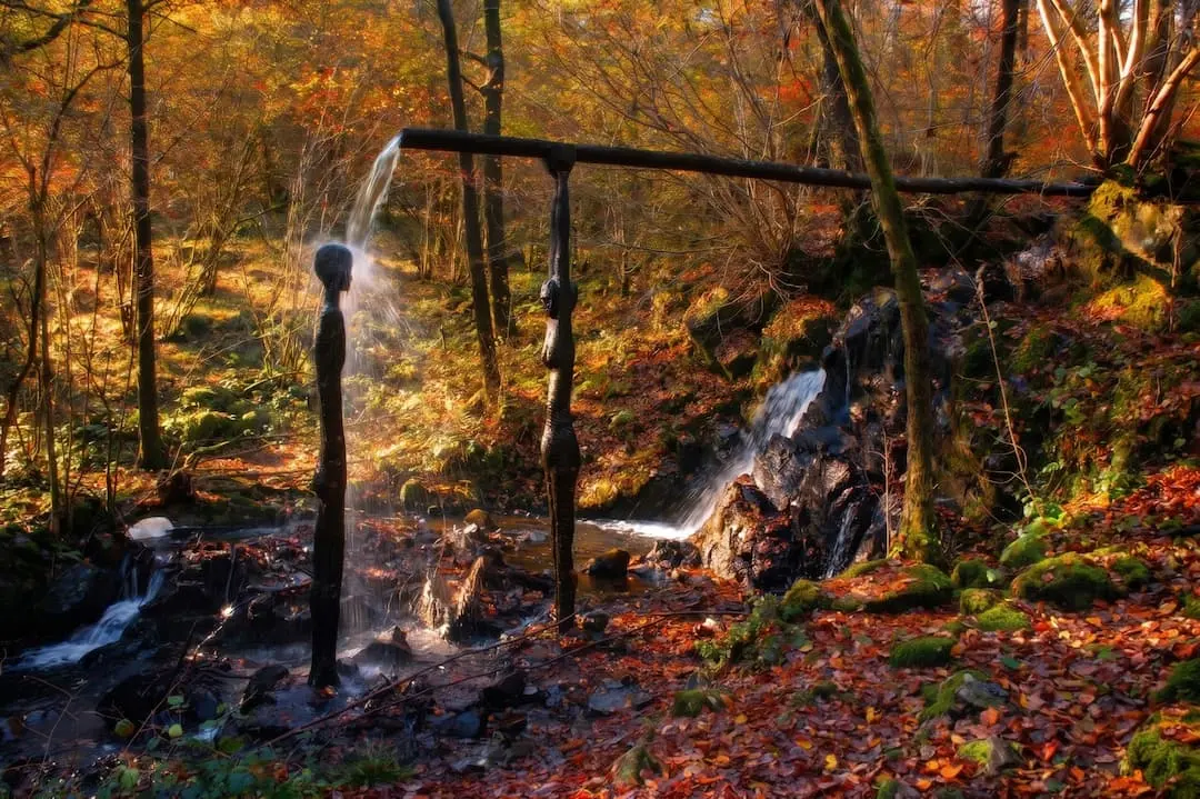
Force Falls, Grizedale
A circular walk through Grizedale Forest, its sculptures and Satterthwaite village to the hidden cascade of Force Falls. Free GPX, parking and tips.
Read guide: Force Falls, Grizedale →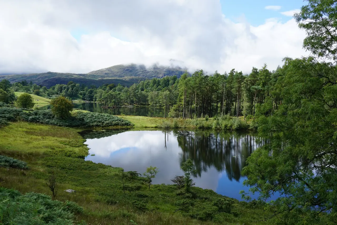
Black Crag & Tarn Hows
A circular walk linking the Tom Gill waterfalls, Tarn Hows and the Wainwright summit of Black Crag above Coniston. Free GPX, parking and timings.
Read guide: Black Crag & Tarn Hows →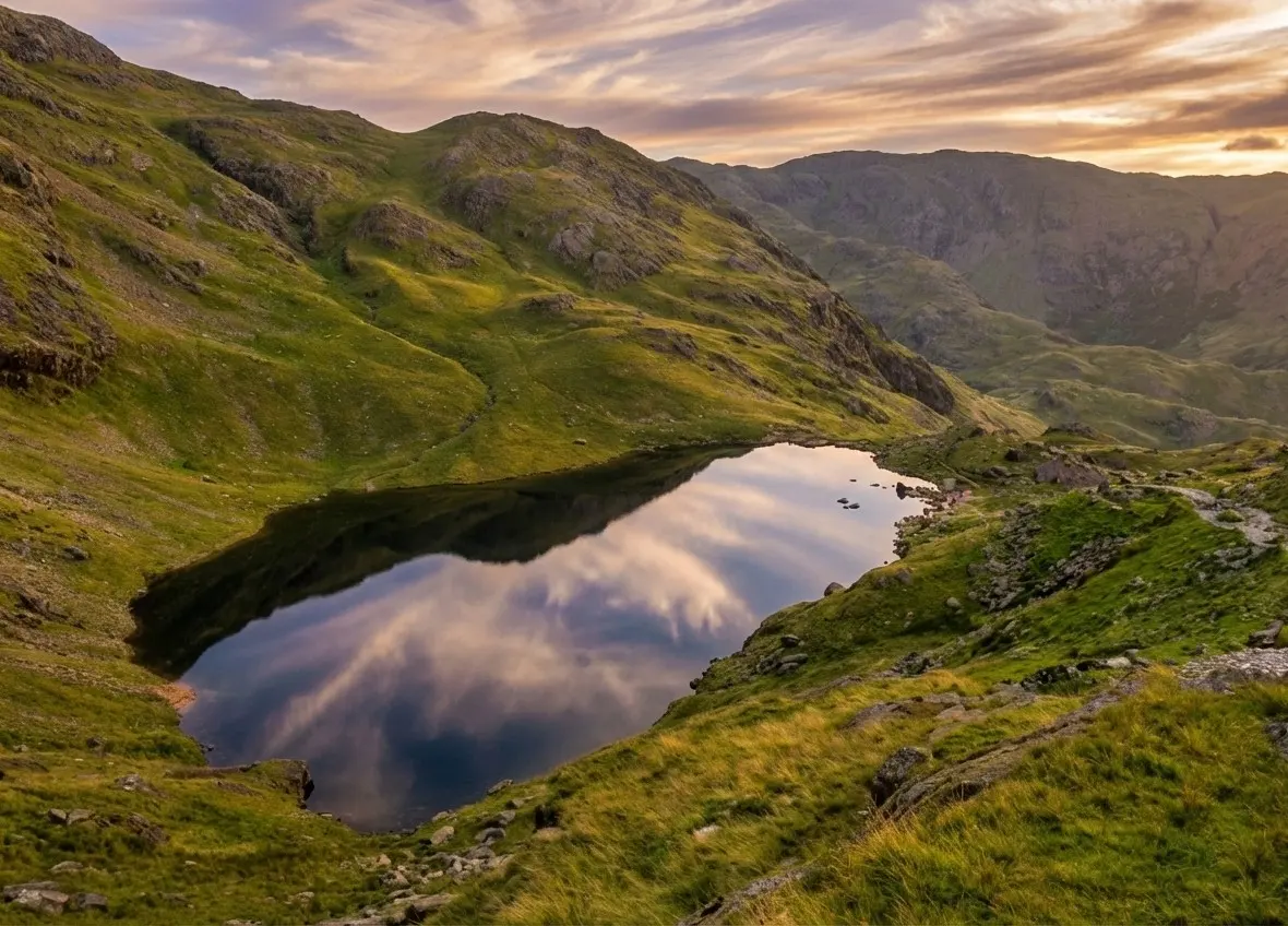
Old Man of Coniston
Old Man of Coniston circular walk: 8.1 km and 3.5–5 hours via Low Water and Goat's Water, with route map, free GPX, car park, difficulty and summit facts.
Read guide: Old Man of Coniston →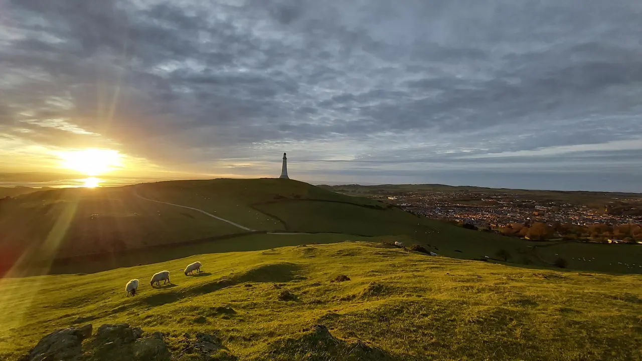
Hoad Hill
Hoad Hill walk from Ulverston town centre to the Sir John Barrow Monument, the 'lighthouse' on the Hoad: route map, parking, free GPX and Morecambe Bay views.
Read guide: Hoad Hill →More walks in South Windermere →
Similar walks elsewhere

Rydal Caves
An easy circular walk from White Moss through woodland and along Rydal Water to a vast slate cavern with stepping stones. Free GPX, parking and tips.
Read guide: Rydal Caves →